Today day started out like many others - it was a Friday and if you're a
professional cameraman you sleep in because you don't have a regular job -
LOL.
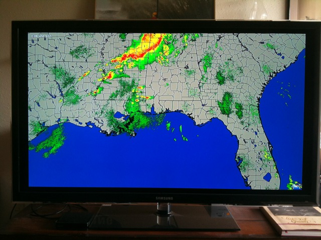
Actually I was in the living room messin with the new Roku box and figured out how
to get a full HD weather underground radar loop on my huge 55 inch HD TV.
Whoa, I was in doppler heaven. No more lizard or progressive
insurance commercials to watch! It turns out that the Storm
Prediction Center had posted a moderate risk for tornadoes just to my
north near the AL/FL border. As I sat there and marveled at the beautiful
jumbo size radar loop it dawned on me that supercells were firing just
north of Mobile AL. Shoot, I am way behind the eight ball here!
I made a bee line to the gear room. I found an old laptop
with StreetAtlas 8 from 2003 running on it, grabbed my still cam bag and
headed out the door. My new video cam wouldn't be here till Monday so
the Canon 5D2 was going to have to work double duty on this trip. There
wasn't much time to do the usual prep and run down the checklist. I
could always figure out what I forgot when I saw a tornado right?
I had a good road north and made it to the FL/AL border.
I called
Jeff Gammons in South FL and asked if he could watch the radar for me
because in rural Sweet Home Alabama you cannot get internet data most of
the time and sometimes not even a cell phone signal. Some folks won't even chase in hilly wooded terrain
because you can't see that wedge on the other side of the tree line and I
don't blame them.
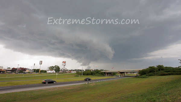
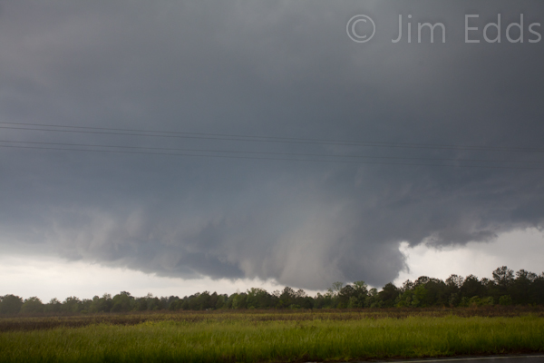
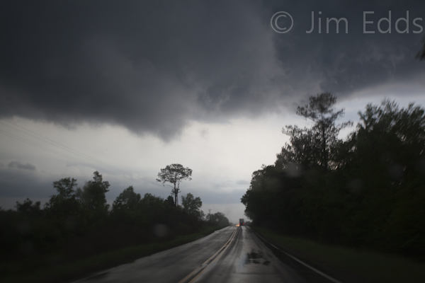
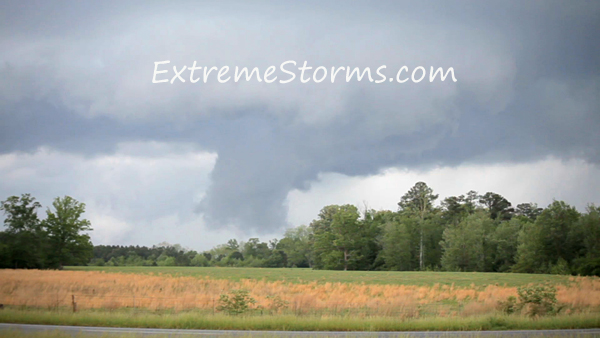
I made my way to Awin and got in the rain free slot and filmed the rotating wall cloud at 3:47pm 1/4 mile from me. No tornado yet but it was really spinning wildly and that lightning was zapping all around me as I was outside the car filming. It crossed highway 10 moving NE. I decided to have another go at it and headed down the road a few miles and jumped on I65 toward the northeast. Just outside Greenville, I filmed the wall cloud as the tornado sirens went off. There are reports of a tornado about the time I shot this footage but I cannot confirm from where I was. Those sirens were really blasting my ears good - they were actually painful. The amazing part to me was the interstate traffic was totally oblivious to the approaching danger. I climbed up a hill and maybe they didn't have the view I did. I shot this photo with a 17-40mm lens at 4:05pm
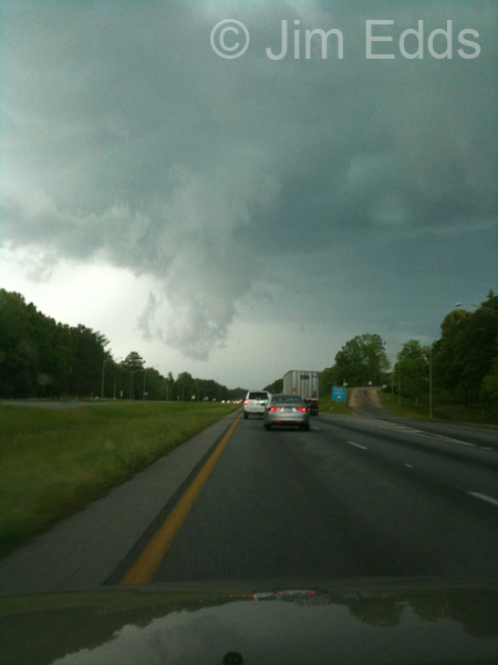
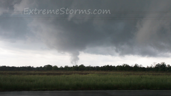
So I followed this supercell up the road a few miles and took this iphone shot at 4:09pm as it crossed the road in front of me.
I then continued on to Fort Deposit and exited east (see
map). The supercell cycled down so I made a big 70 mile circle
from Panola to Rutledge then back to Greenville. This was a mega
tornado day and storms were firing again to my southwest north of Mobile.
Jeff Gammons called me and advised there was a new tornado warned
supercell moving toward the same area that I filmed the first one.
Imagine that! Jeff was watching the high res radar from WeatherTap
and relayed some additional guidance data from the NWSO Mobile that said a
tornado was on the ground and the path had it crossing highway 10 at
5:53pm. I had to go through downtown Greenville and all 3 red lights
(see this is why you want to live in Greenville). I made it to "the
spot" with about 5 minutes to spare. Only trouble was those Sweet
Home Alabama pine trees. I had trouble finding a clear area with a
wall cloud or worse bearing down on me. I could see it between
the cracks in the trees. I later found out a tornado had touched
down in Bultler Springs 2 miles SW of me.
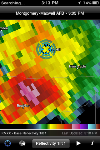
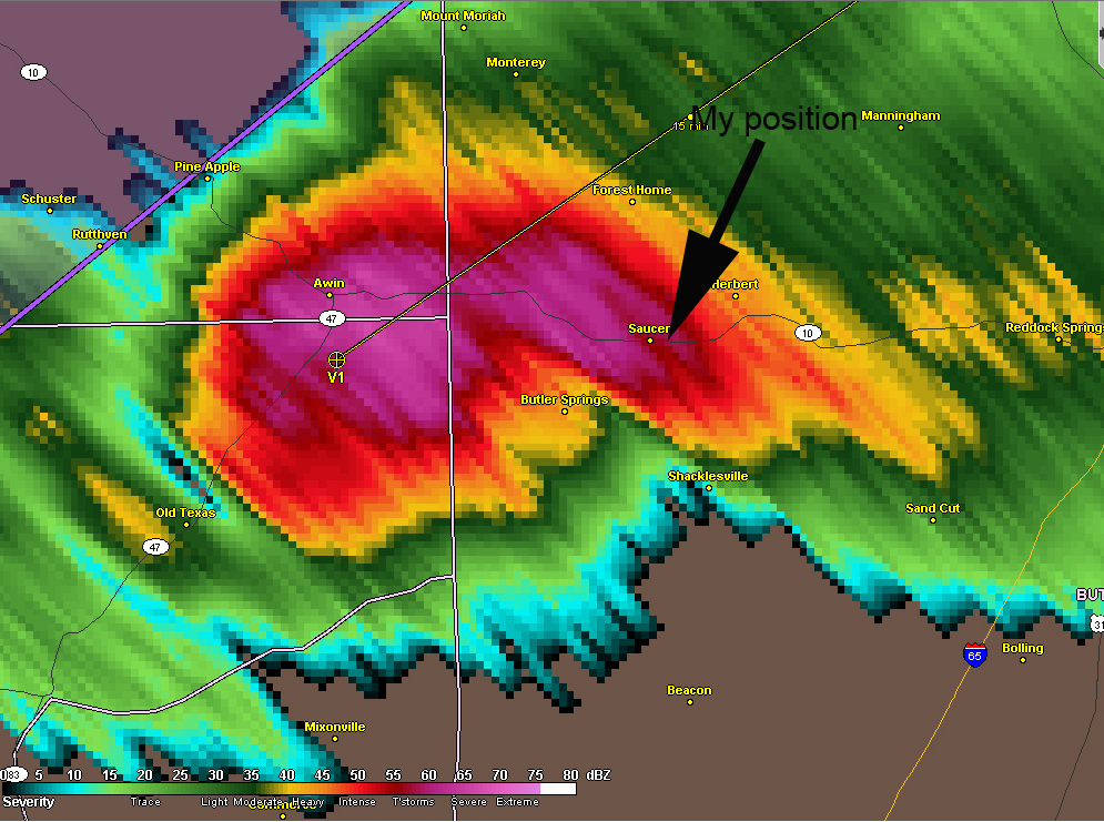
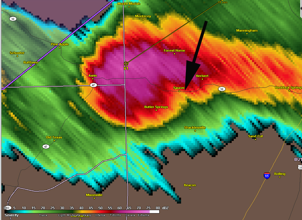
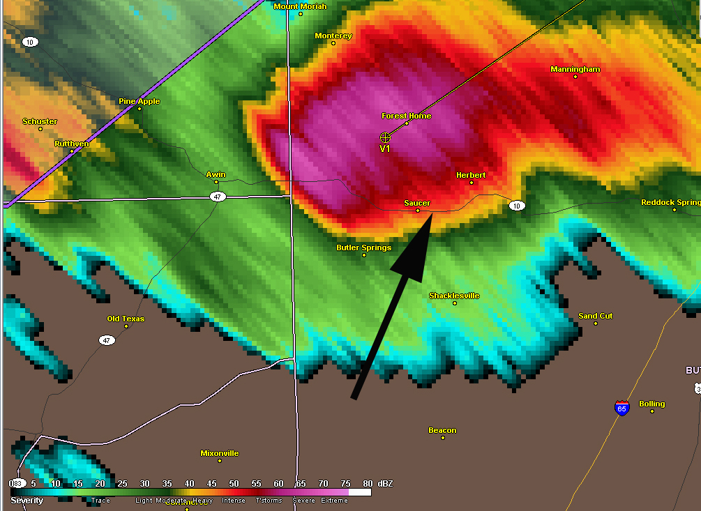
Here is the radar sequence courtesy of WeatherTap. I had taken a photo with my iphone so my position was GPS tagged. To give you some scale, it's just short of 2 miles from Saucer to Butler Springs.
This reminded me of a game of chicken. Of course I was going to bail but when you're getting good video at what point to you relocate? I saw a small tornado spin down to my left and said ok, if it goes left of me I'm good!
I kept my eye and camera on that "little" tornado because
I knew another even bigger one could spin up in no time. I recall a
lady drove by me and stopped. She walked over and said, "Is that a
tornado"? She's was pretty scared. A few other scared folks
pulled over where I was and figured they would just "hang with the storm
chaser" until all this past by. Just then an "I ain't stoppin
for nothing" trucker goes by me and I desperately point in front of me
towards the tornado/wall cloud. He was going to drive right into it.
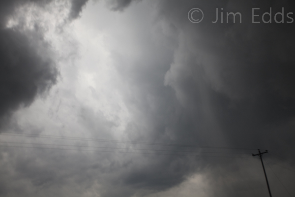
I collapsed the tripod and tossed it in the car (yes, threw it in and didn't care how it landed) then headed after the tornado. It was definitely cycling up and I wanted to stay with it. 1/4 mile down the road that trucker had stopped and I saw the tornado cross right in front of him. I mean it was just 100 yards in front of him. I Didn't get a shot of it as the darn cam was still locked on the tripod. I did finally manage to get it free and took a few shots as the rest of the wall cloud moved overhead. Photos taken at 5:56pm on highway 10 eastbound toward I65
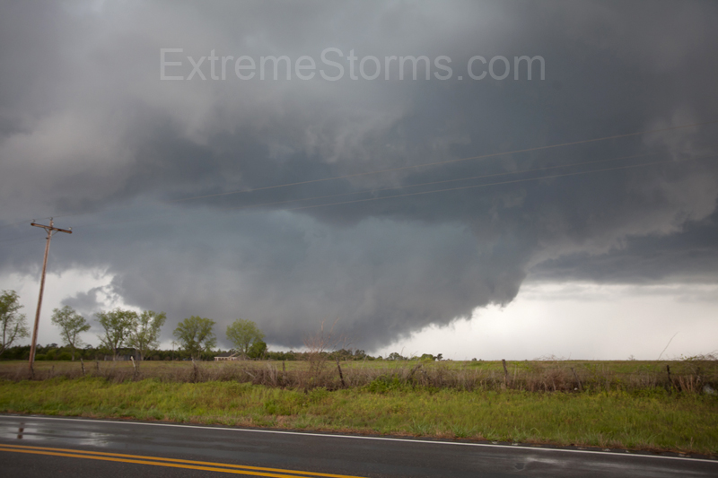
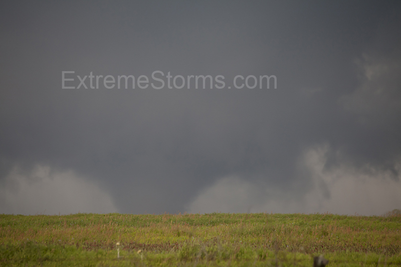
I could see between the tall pine trees the wall cloud was consolidating but I just couldn't find an open spot to shoot. A few miles down I saw 3 cop cars pulled off the road in a flat open area. I knew immediately what they were looking at. I pulled over and started filming. At 6:01 I filmed this.
At 6:06pm it turned into this
I was shooting slightly up hill so I didn't get the ground level action but in this terrain I was lucky to get these shots. I made my west to I65 (again) and headed northeast and filmed the wall cloud again at 6:27pm
After I took this shot the supercell cycled down so I
decided to head back home to Pensacola before it got too late. You
can see the video here on Jeff Gammons'
stormvisuals.com site. All in all today was really
exciting and a big thanks to Jeff for the excellent radar analysis.
The dude is good. Jim Edds Back to homepage
ExtermeStorms.com |
